
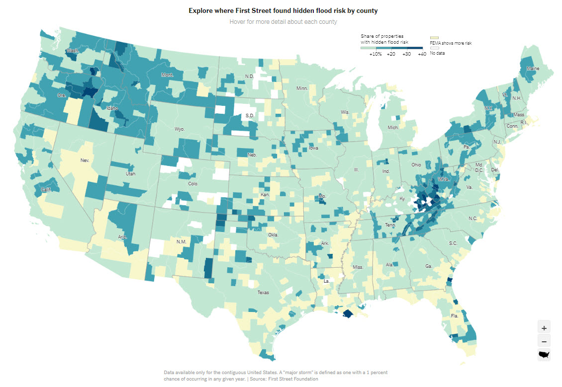
New scientific modeling demonstrates hidden flood risk
Extensive new data modeling shows a harsh new reality that millions of Americans are at risk of flooding. Groundbreaking research from First Street Foundation, a non-profit group, highlights that 70% of American homeowners are at risk of flooding that isn’t reflected in current FEMA flood maps. This new data reinforces just how urgent and important it is to get flood coverage in place that homeowners need.
State by State
Impact Reports
Source: New York Times Click the map to check your county.
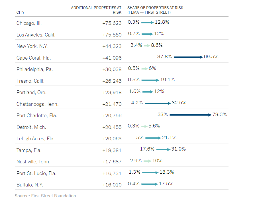
Regions across the country have been shown to have a higher level of risk than previously estimated. The research shows the following cities have the highest number of additional properties at risk.
What does it mean?
First Street’s Flood Model takes into account a number factors that FEMA’s maps do not. These factors include: a rise in sea level as well as an increase in sea water temperature and changing weather patterns. We’ve long assumed that environmental factors played a significant role in the increasing frequency and severity of flooding in the U.S. and First Street Foundation’s research supports that conclusion.
Agent Resources
These templates were designed with a number of scenarios in mind.
We’re sure that you’ll find these tools valuable as you review
your clients flood insurance needs
campaigns for your policyholders?
We can help!